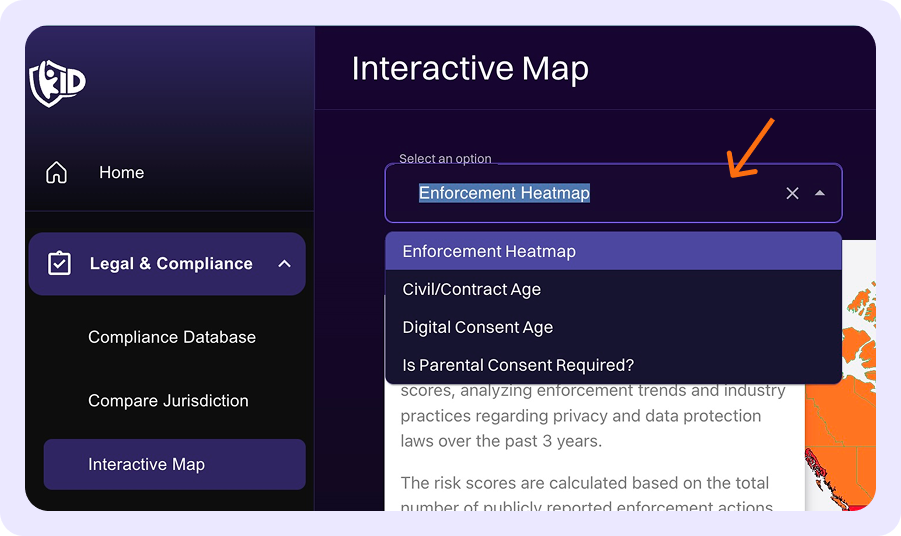
Interactive Map
The Interactive Map tab provides a visual overview of compliance requirements across jurisdictions, helping you quickly understand the global distribution of each requirement. To get started, click the dropdown menu to select the specific map you want to view.
How to Use the Interactive Map
-
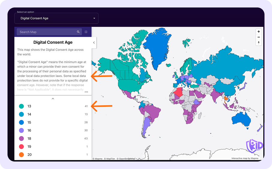
Map Selection and Overview: Each map includes a brief description of what it displays (click on the shaded area to expand and read more), along with a color-coded legend that explains what each color represents. The legend also shows the total number of jurisdictions in each category.
-
Exploring Categories: Click on a category in the legend to view a list of jurisdictions that fall within that category.
-
Map Interactivity:
- Hover over the map to see the names of jurisdictions.
- Click on a jurisdiction’s location on the map to view its requirements directly.
- Alternatively, use the "Search Map" bar to quickly find and select a jurisdiction by name.
-
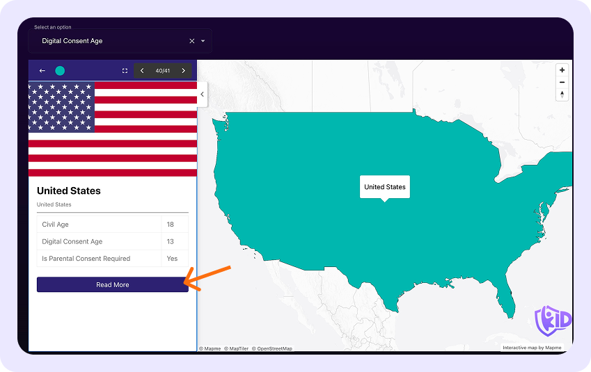
Jurisdiction Details: Click on a specific jurisdiction in the list to see a table of requirements for that jurisdiction.
-
Navigating to Survey Pages: Click the "Read More" button to go directly to the full survey page for the relevant jurisdiction.
-
Zoom Controls: Use the + and – icons at the top right corner of the map to zoom in and out for a closer or broader view. To view the map in full screen, click the expand icon next to the "Search Map" bar.